Русский
  English
 A high-precision positioning system of geodesic class PRO-GEO is presented on an international platform
One of key areas of activity of "NIIMA "Progress" JSC (part of "Element" Group of Companies, MOEX:ELMT) is development of navigation solutions, an urgent area of technological development in the modern world that requires special attention to ensure technological independence.
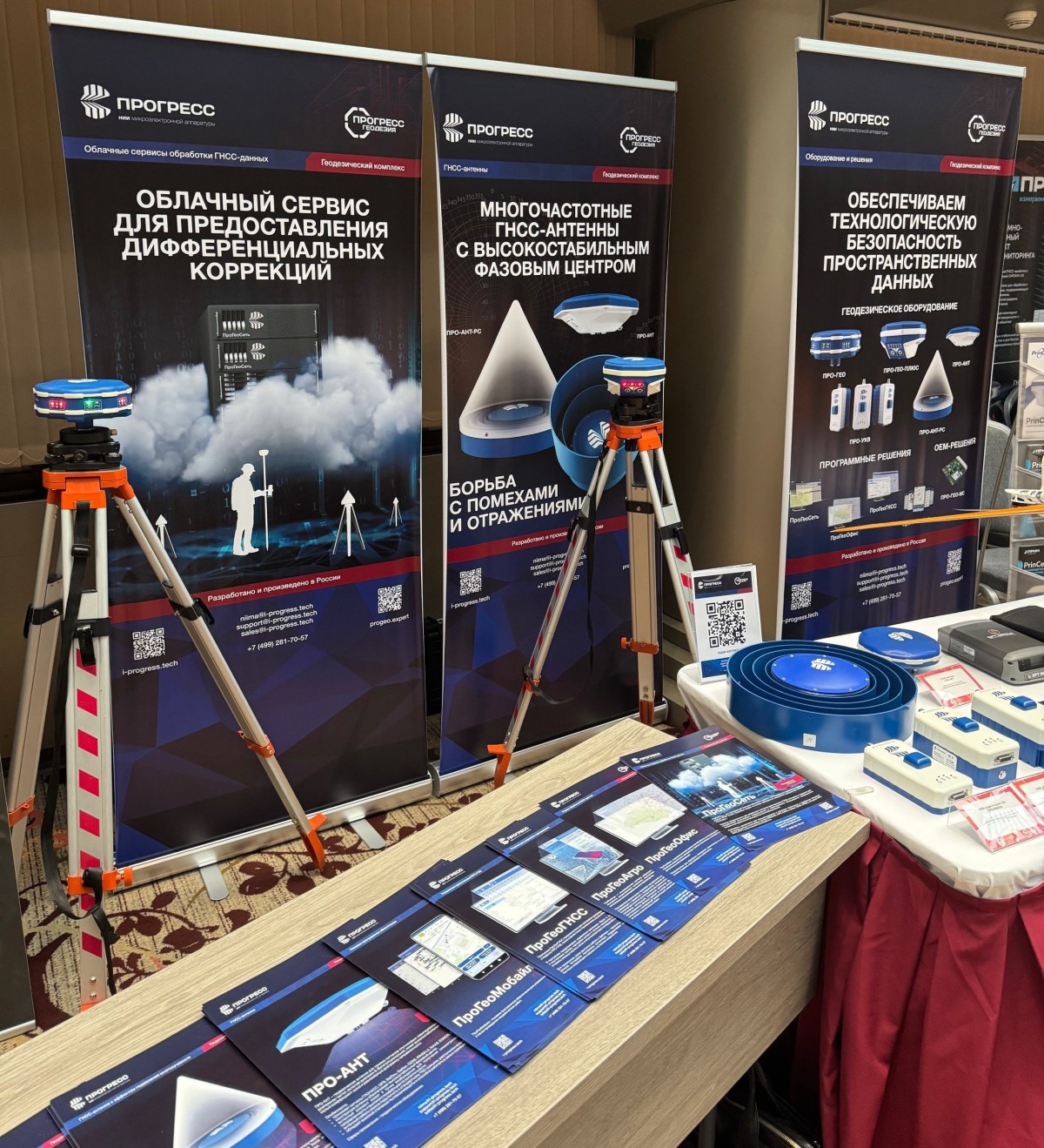
At the XVII International Scientific and Practical Conference "Geodesy. Surveying. Aerial photography. Navigation", the company presented at its stand a high-precision geodesic software and hardware complex PRO-GEO, which includes all necessary range of software and hardware.
As part of the event business program, two reports were presented by experts from "NIIMA "Progress" JSC. In a report entitled "post VRS. New possibilities", information was provided on features of obtaining object coordinates based on data from physical and virtual (VRS) base stations, on methods for comparing different solutions, as well as on possibilities of the postVRS method, when an accuracy of obtaining an object location is achieved using post-processing of virtual base station data.
The report also presented results of an effectiveness test of using postVRS to obtain coordinates in motion, conducted on November 6, 2025 using a mobile laboratory of the company. In this experiment, satellite receivers developed by NIIMA "Progress" and a foreign manufacturer were used . The receivers were controlled using ProGeoMobile software (NIIMA "Progress"), and RTK operation was performed using base stations network by EFT Group. An integrated controlling system ProGeoNet (NIIMA "Progress") was connected to the network. One of the receivers was working from a nearest stable physical station, and other two were connected to VRS.
The test results showed, in particular, that a number of fixed solutions received from the virtual station is twice as much as from the physical one. At the same time, as initially expected, in terms of the number of fixed solutions, real-time VRS has no advantages over connecting to a physical station at a distance of up to 30 km.
The experiment confirmed that the postVRS method has a number of advantages, including the ability to select an optimal post-processing mode in difficult conditions based on analysis of measurement and statistical discrepancies, interpolation of base station data, etc.
The second report was devoted to achievements of NIIMA "Progress" over the past year in creation of the geodetic hardware and software complex PRO-GEO. The company's expert noted that to solve main tasks of a geodesist, topographer, surveyor and cadastral engineer, an integrated ecosystem is needed, including not only a geodetic satellite receiver, but also a structure for providing corrective information, information support tools, processing and presentation of measurement results, and introduced an audience to a composition of the PRO-GEO hardware and software complex, including, in addition to receivers, several options for external antennas, modems and other equipment, as well as number of software solutions, namely ProGeoNet cloud service, ProGeoOffice software, and ProGeoMobile.
Speaker said that serial production of a number of the complex hardware components has been launched, i.e. PRO-GEO and PRO-GEO-PLUS receivers, a PRO-VHF modem, PRO-ANT and PRO-ANT-RS antennae. Their launch to the market is planned in the near future, immediately after completion of certification tests. The software solutions of the complex (ProGeoOffice, ProGeoNet, and ProGeoMobile) are included in the Unified Register of Russian programs for electronic computers and databases and are already actively used by consumers.
Having described in detail a number of services implemented by the PRO-GEO complex, such as monitoring of base stations, NRTK and VRS data generation service, and RUPOS coordinate calculation service, the enterprise expert shared with an audience the directions for further development of the complex, including creation of a series of antennae that reduce an impact of industrial interference, receivers with an increased degree of localization, and a specialized integrated circuit (ASIC) of its own design, as well as use of artificial intelligence.